Merida Maps and Orientation
(Merida, The Andes, Venezuela)
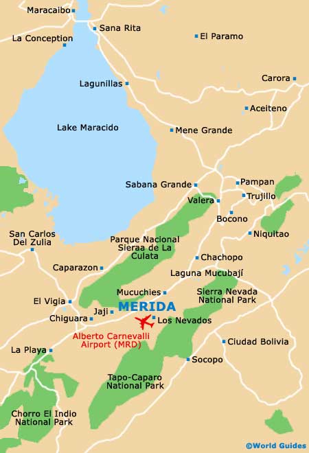
To give it its full name, the Venezuelan city of Santiago de los Caballeros de Merida lies inland in the foothills of the mighty Andes mountain range, on the western side of the country. Merida is set high in the Chama River Valley between two opposing mountain spurs, the Sierra Nevada de Merida and the Sierra la Culata. Its backdrop is the country's tallest mountain, the Pico Bolivar, named after Venezuela's most-loved hero.
Four main rivers flow through the fertile valley, the Chama, the Albarregas, the Mucujun and the Milla, and the lower part of the valley contains small lakes. A major tectonic fault lies beneath the city, giving rise to many hot springs with medicinal benefits, as well as the occasional earthquake. Merida is surrounded by forests, with conifers to the south, cloud forests on the northern and eastern heights, and seasonal jungle to the west.
Maps and Orientation of the City
The centre and historic quarter of Merida city sits on a flat plain, with its suburbs and outlying village areas set on the sloping sides of the Andean foothills, giving a 400-metre / 1,312-foot difference in altitude between the central and outer zones.
The city is divided into ten districts, with the Casco Central area serving as the historic and cultural heart. The northern end of the city holds its important university, while most of the industrial development is based to the south-west, along with the Metropolitan Stadium and other sports facilities. Merida's airport is set almost in the geographical centre of the city and has little room for expansion as a result.
- Apartaderos - 45 km / 28 miles (50 minutes, north-east)
- Bailadores - 90 km / 56 miles (one hour and 15 minutes, south-west)
- Bocono - 100 km / 62 miles (one hour and 25 minutes, north-east)
- Caracas - 509 km / 316 miles (eight hours and 45 minutes, north-east)
- Chiguara - 45 km / 28 miles (50 minutes, west)
- Ejido - 12 km / 7 miles (15 minutes, south-west)
- Jaji - 22 km / 14 miles (25 minutes, west)
- La Azulita - 38 km / 24 miles (45 minutes, north-west)
- La Parroquia - 11 km / 7 miles (15 minutes, south-west)
- La Venta - 58 km / 36 miles (one hour, north-east)
- Lagunillas - 180 km / 112 miles (north, two hours and 30 minutes)
- Los Nevados - 17 km / 11 miles (20 minutes, south-east)
- Maracaibo - 225 km / 139 miles (two hours and 45 minutes, north)
- Maracay - 822 km / 511 miles (12 hours and ten minutes, north-east)
- Margarita - 516 km / 321 miles (eight hours, north-east)
- Mucuchies - 30 km / 18 miles (40 minutes, north-east)
- Niquitao - 78 km / 48 miles (one hour and 15 minutes, north-east)
- San Cristobal - 150 km / 93 miles (two hours and 15 minutes, south-west)
- San Francisco de Yare - 513 km / 318 miles (eight hours, north-east)
- San Rafael - 50 km / 31 miles (55 minutes, south)
- Santo Domingo - 62 km / 39 miles (one hour, north-east)
- Tabay - 11 km / 7 miles (15 minutes, north-east)
- Trujillo - 115 km / 71 miles (one hour and 30 minutes, north-east )
- Valera - 100 km / 62 miles (one hour and 25 minutes, north-east)
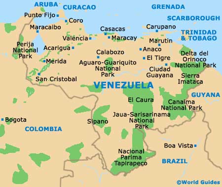
Map of Venezuela
Map of Merida